
Our current dGPS research is described on our ice tracker page
LIVE Data from the 203 systems are available here

Topcon Legacy-E reciever
Previously we used two receivers from Topcon (Legacy) to measure the location of the ice base station precisely. This worked by recording signals simultaneously on both then using their software in order to calculate the position. This can be as accurate as 5mm. The recordings do take some time – 15mins for example and the results vary according to how many common satellites the systems see. Each unit had a 256MByte compact flash card which acts as a data backup in case we did not retrieve the data. In Iceland we also used Leica units on loan from NERC to measure many more points on the glacier.
We wrote software which runs under Linux to fetch files automatically from the Topcon units.

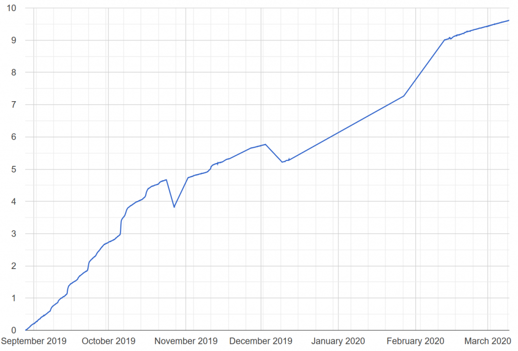
A plot from the Norway deployment which clearly shows movement of the base station
During the 2005/06 deployment the use of real time kinematics was trialed, however for Iceland offline analysis has been used to avoid the need for another wireless link.
Recent data from an array of units on Skala’ has led to good daily movement data.