Iceland fieldwork summary 2024

We had a productive week in Iceland re-photographing and gathering data/equipment.

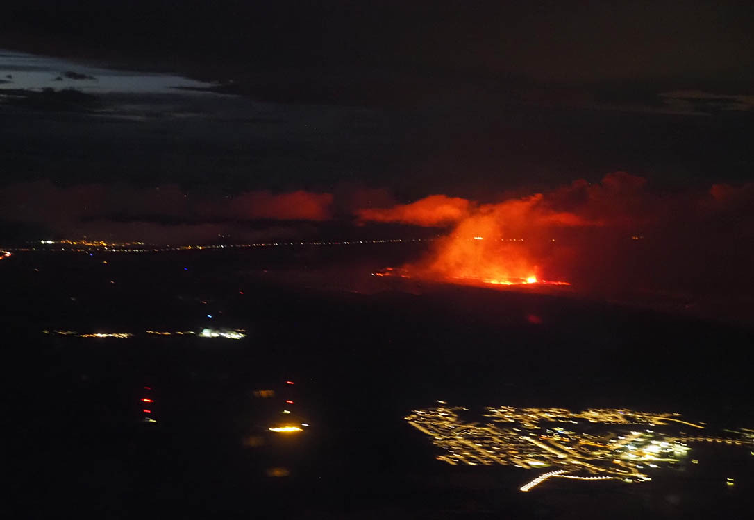
On landing we were able to see the lava from the current eruptions!

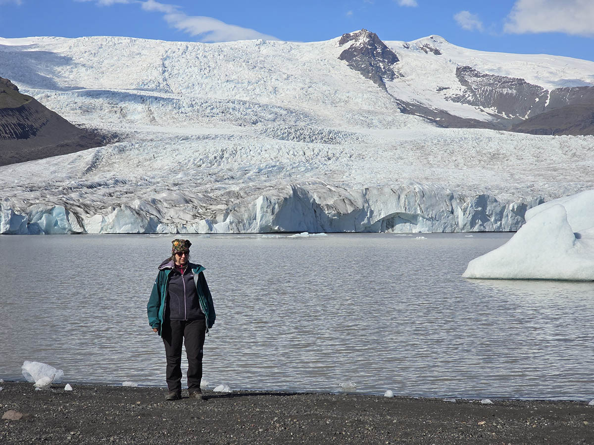
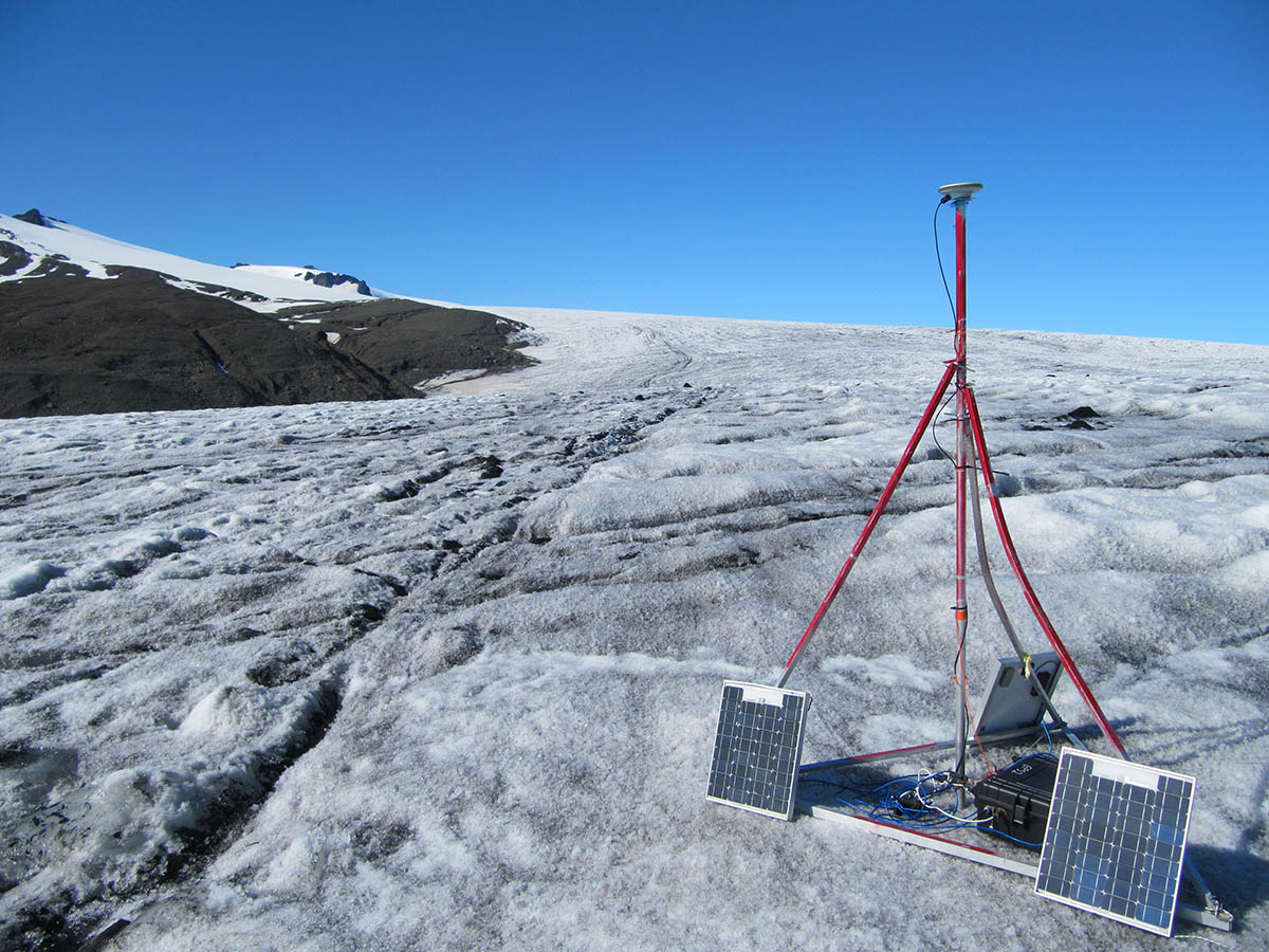
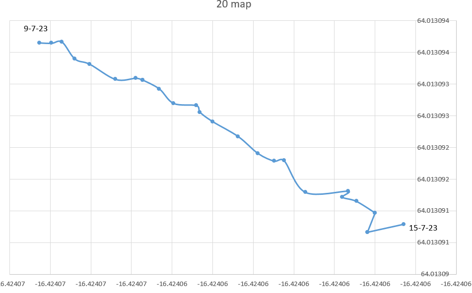
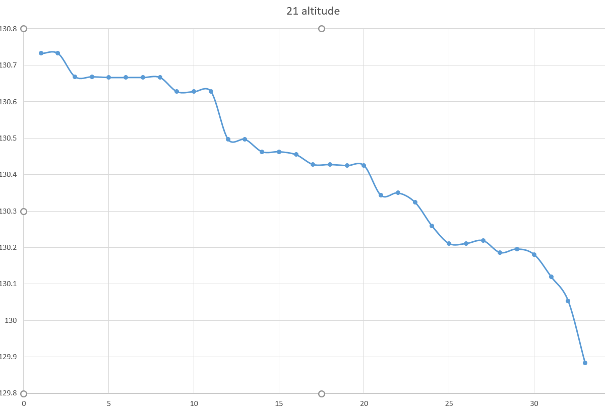
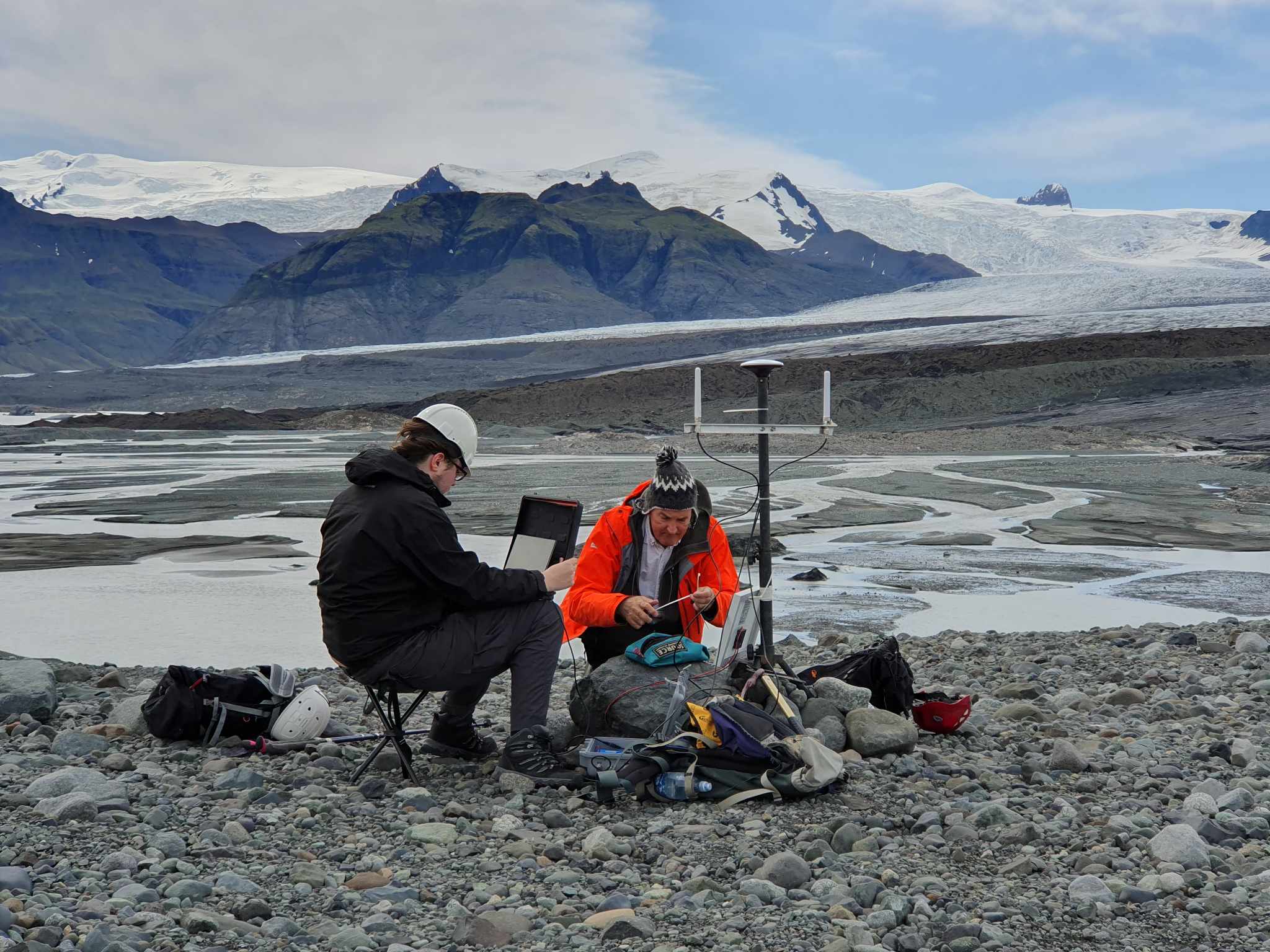
Fjalls looked like it had retreated more – as we walked across to place ground control targets.

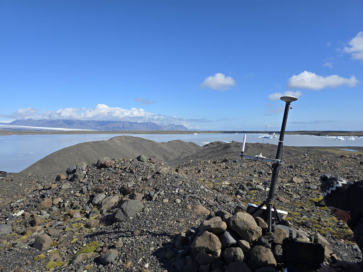
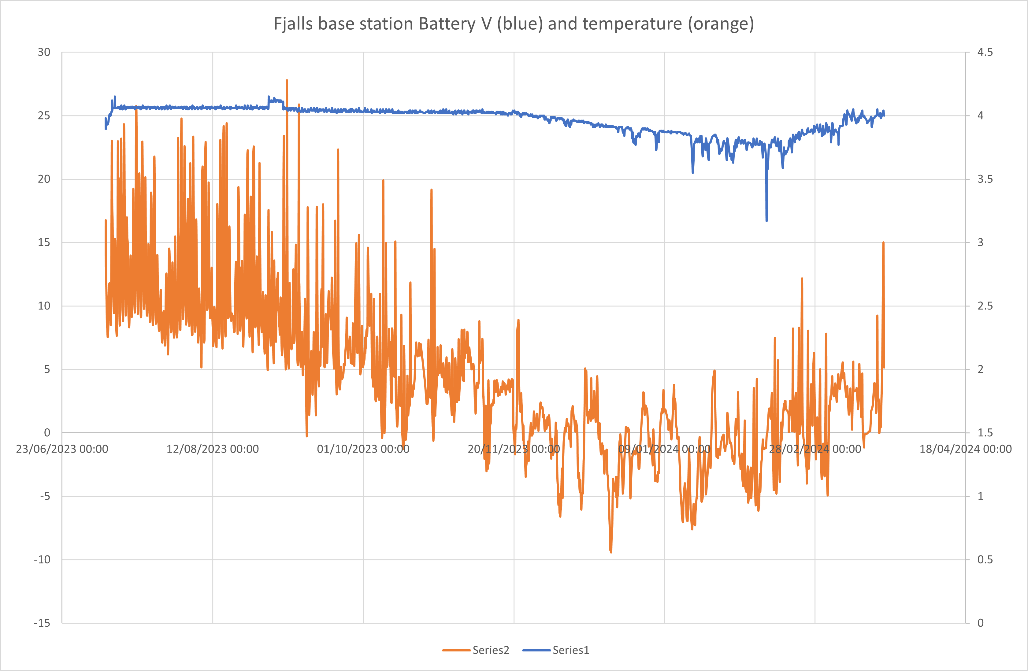
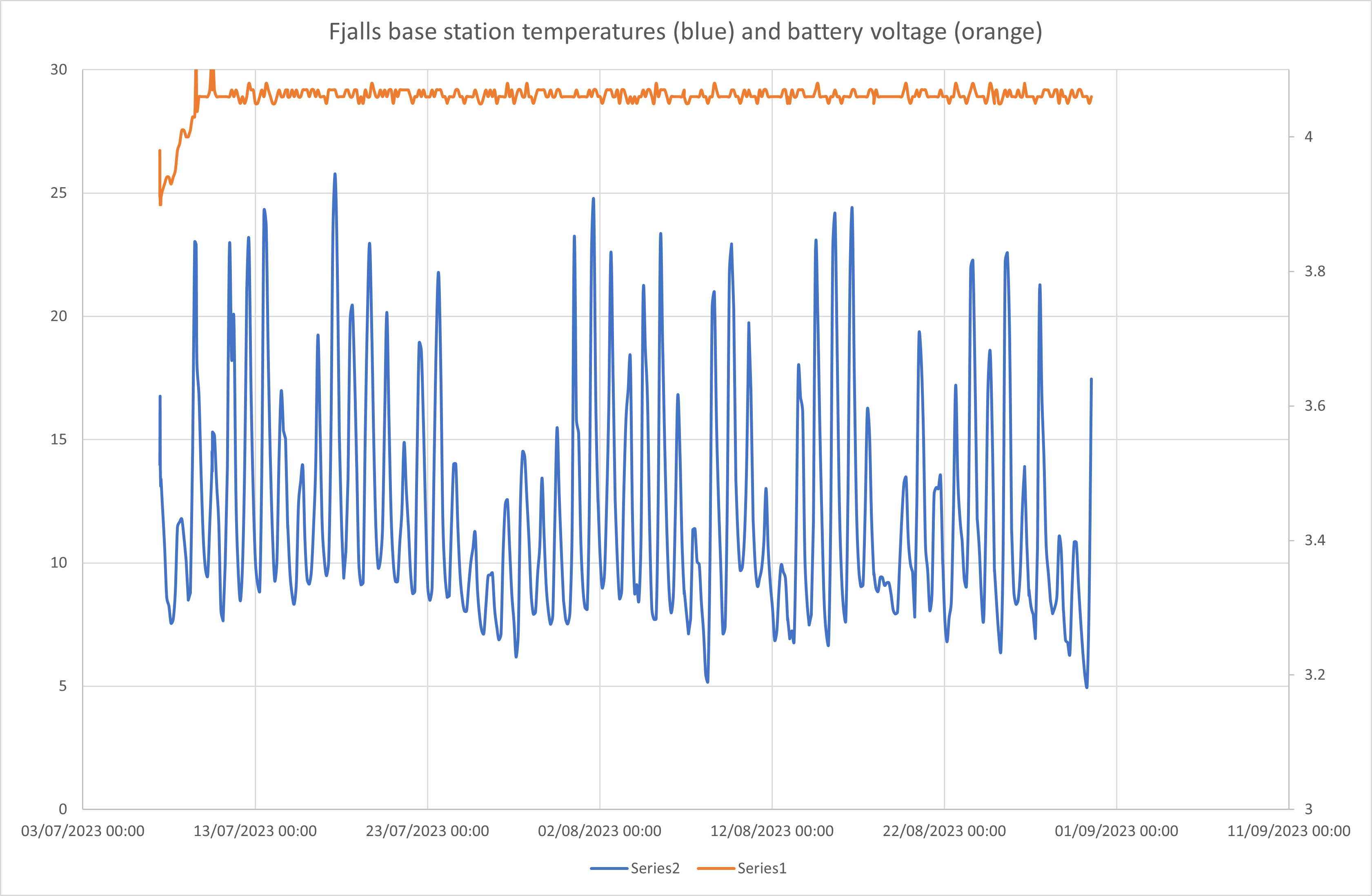
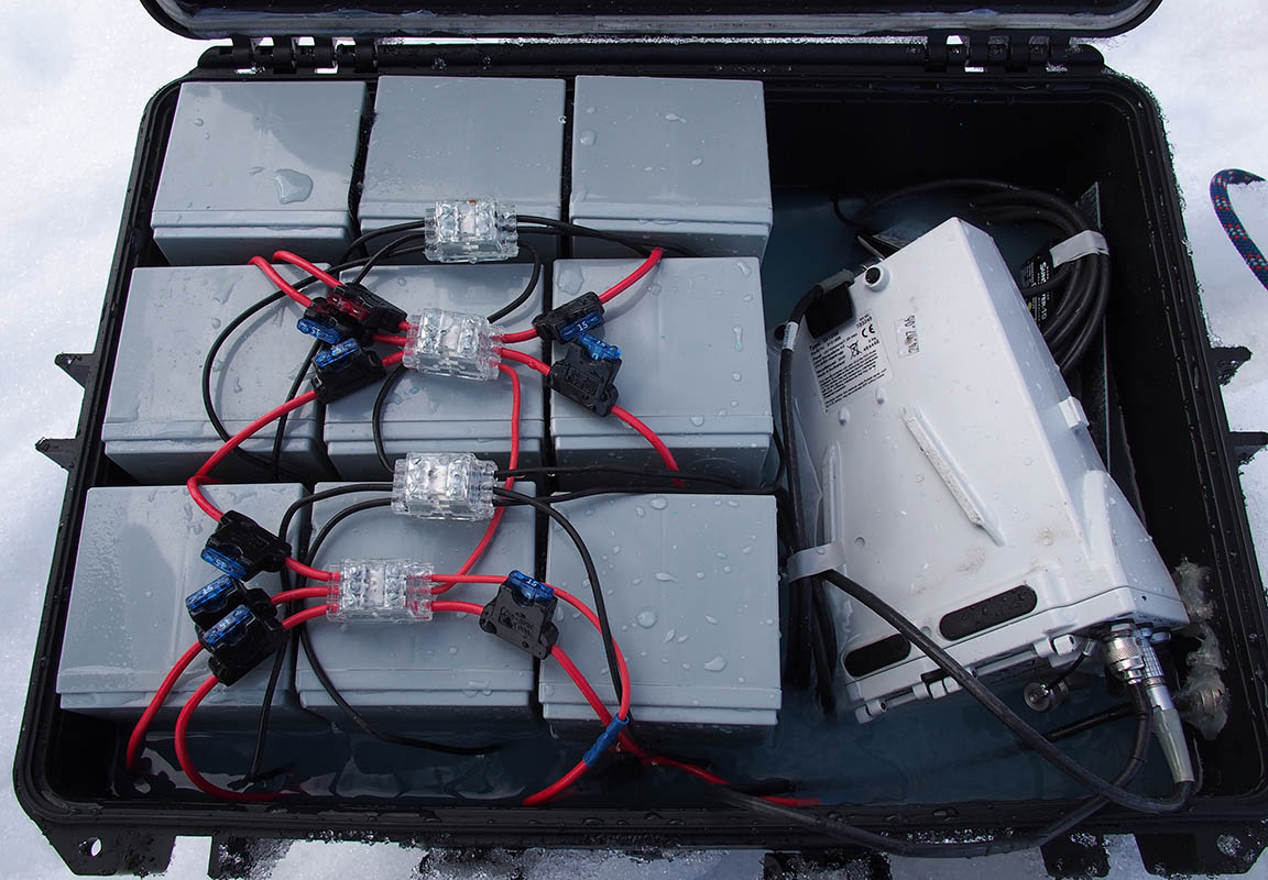
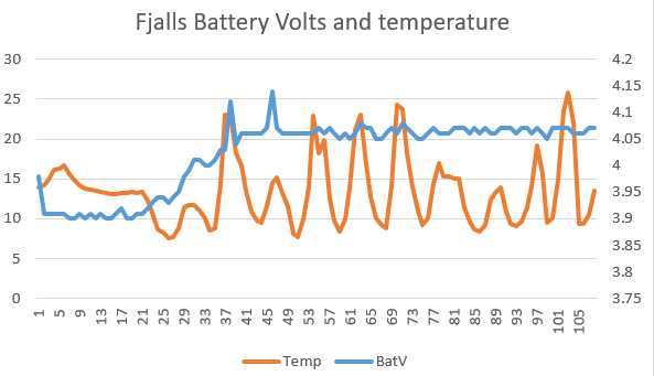
The Fjalls base station had lent over during the winter but was otherwise OK. In fact it was working apart from the disconnected 2G data link (the network was shut down). It had stored the data in flash (as it is meant to do) so we retried hundreds of data points from it! Battery was full!

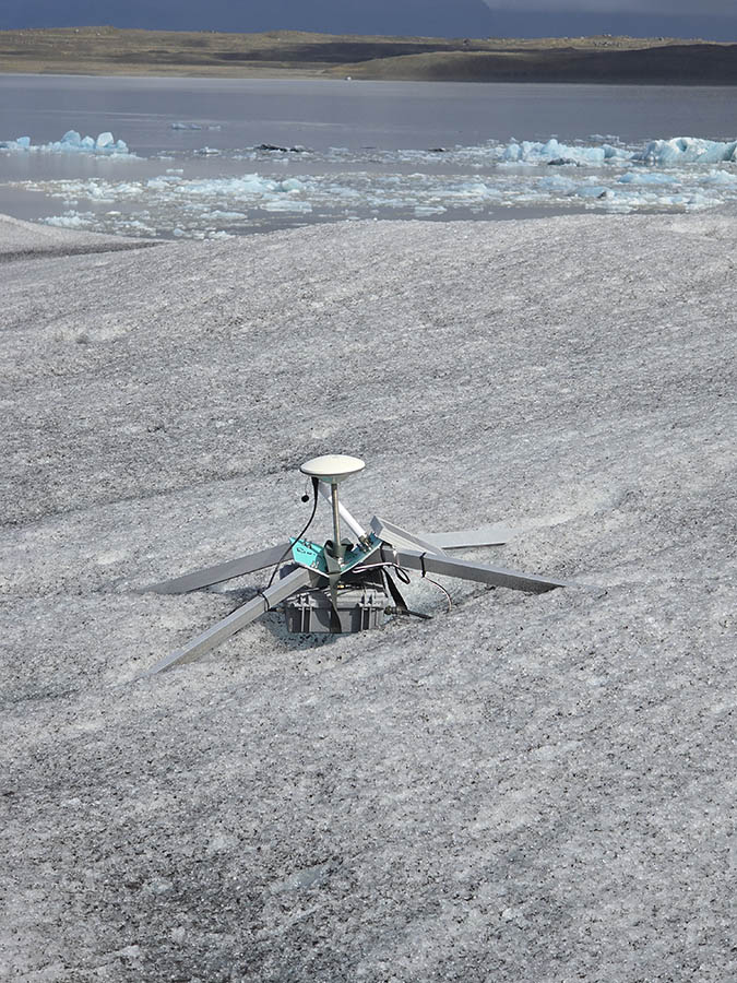
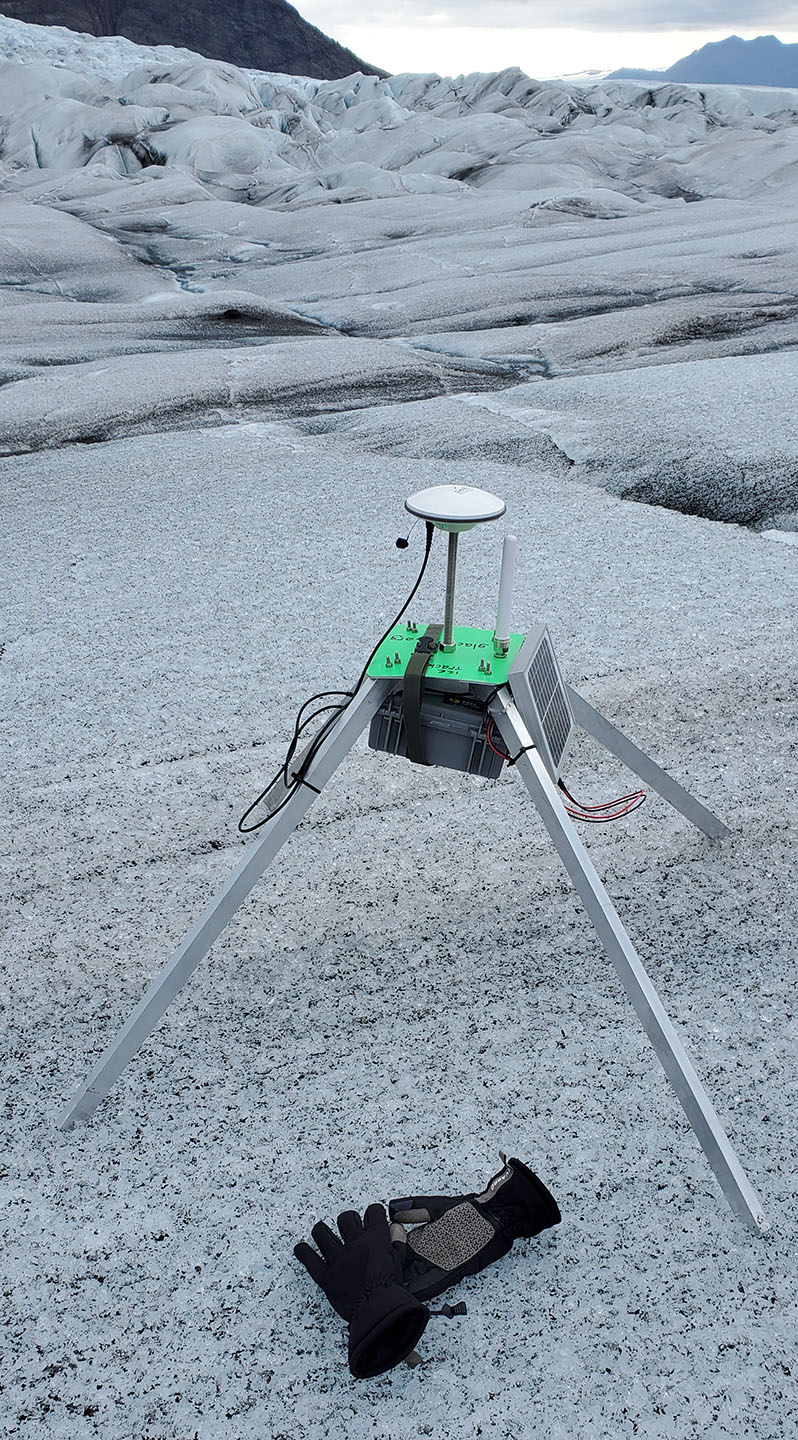
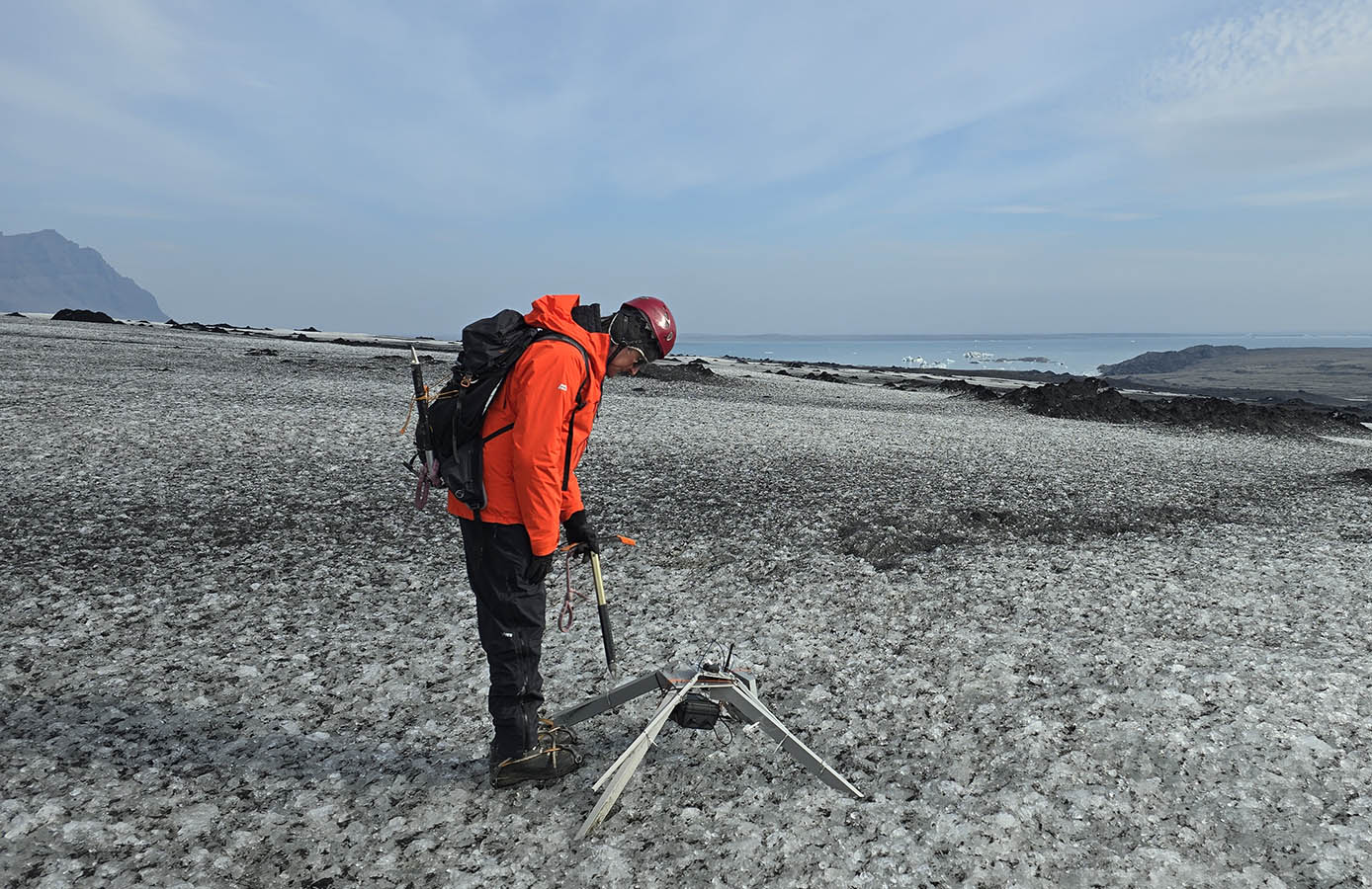
The weaker and lighter v2 quadpods tended to bend in the winter – we underestimated the forces involved. However the node was still working OK! This Fjalls tracker looked like it would drop into the lake soon.

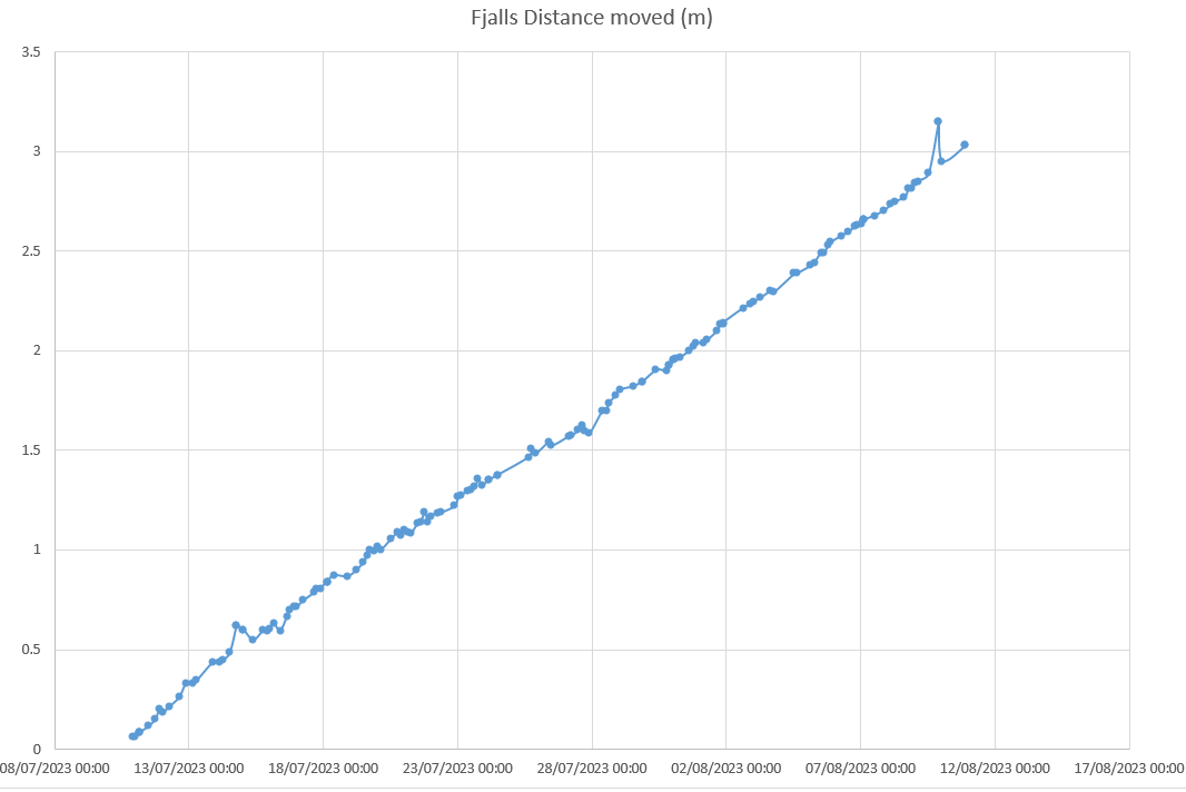
We retrieved the Fjalls rover which was going to fall off the ice cliff later in the year – it had been working OK too – and its battery was in good condition.

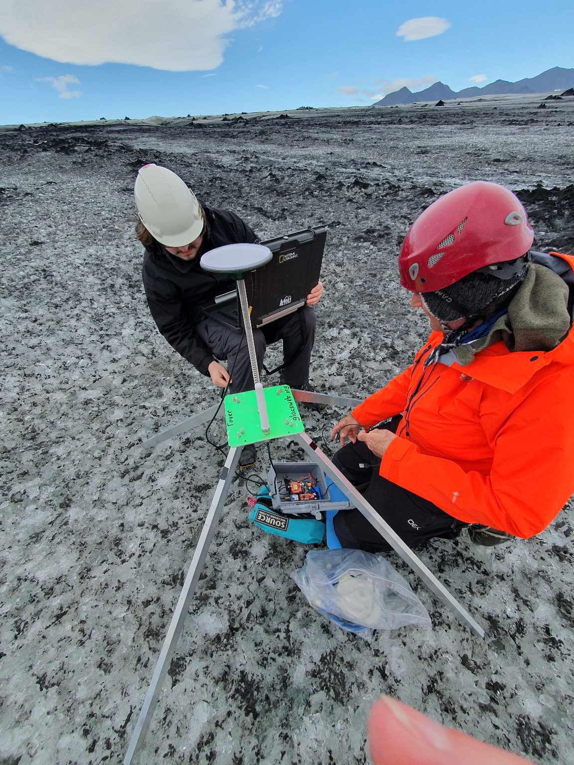
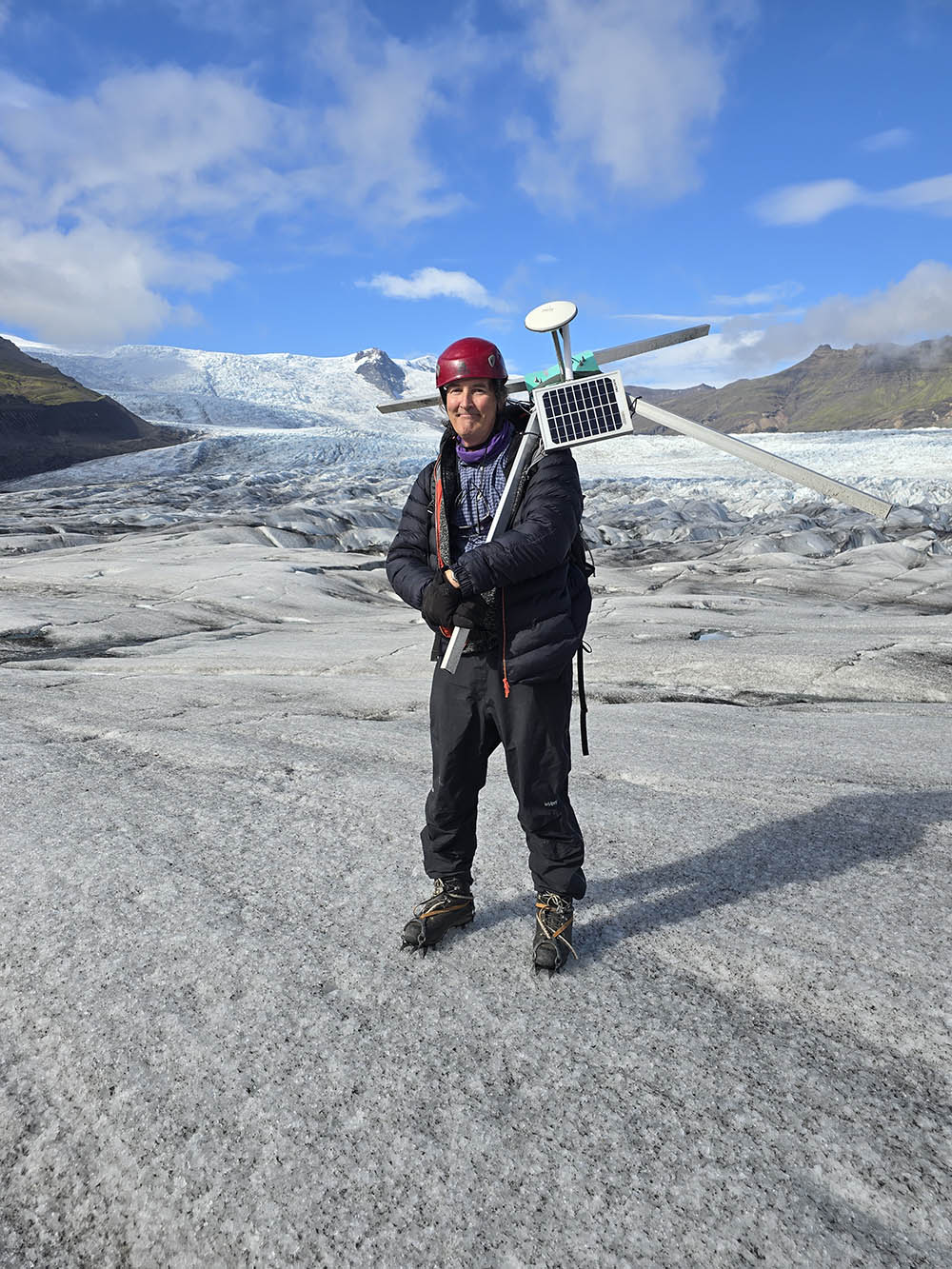
On Breida we walked up to the highest tracker using a location read from its base station (again unsent to UK due to 2G). This tracker has the heli-placed weaker quadpod attached to a stong v1 quadpod and had survived the winter well.

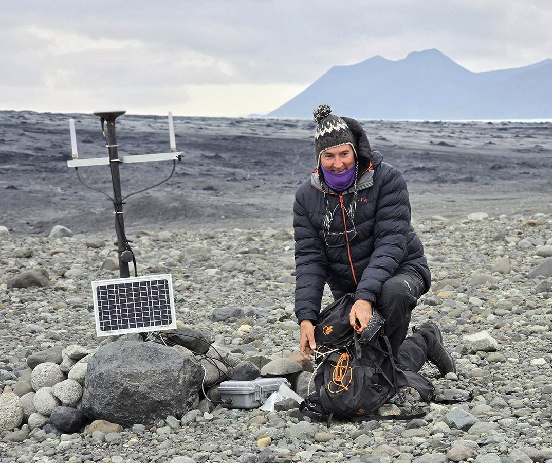
The Breida base station was in good condition considering the year it spend there in the open. It also had hundreds of data points saved! Its battery was also full – showing our new battery+solar system worked well.

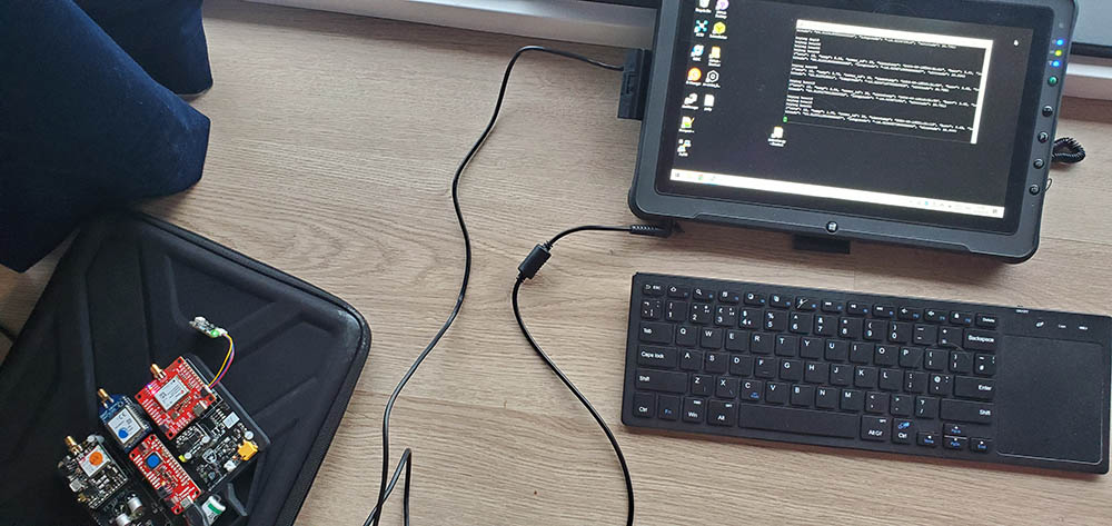
A wierd problem was that so may data files had been stored that the tiny microprocessor could not list all the files. So I wrote an exhaustive searcher which worked its way from august, every day, hour, minute and second.. backwards – so we could see if we had data! It worked incredibly slowly – but when we got back to Southampton I swapped the controller board with a more powerful one and it exported all the data ok!

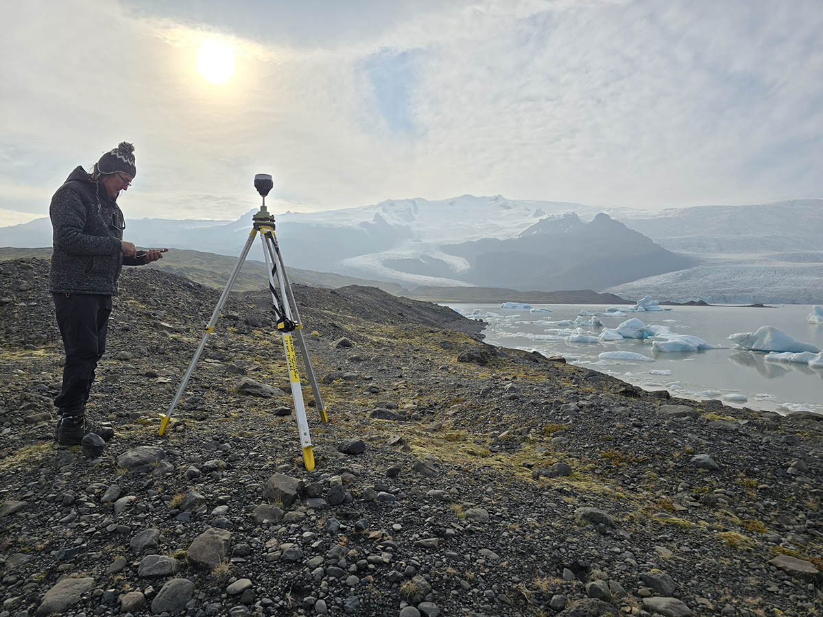
Like last year we used an Emlid DGPS base station to record GNSS data for post processing our drone surveys.

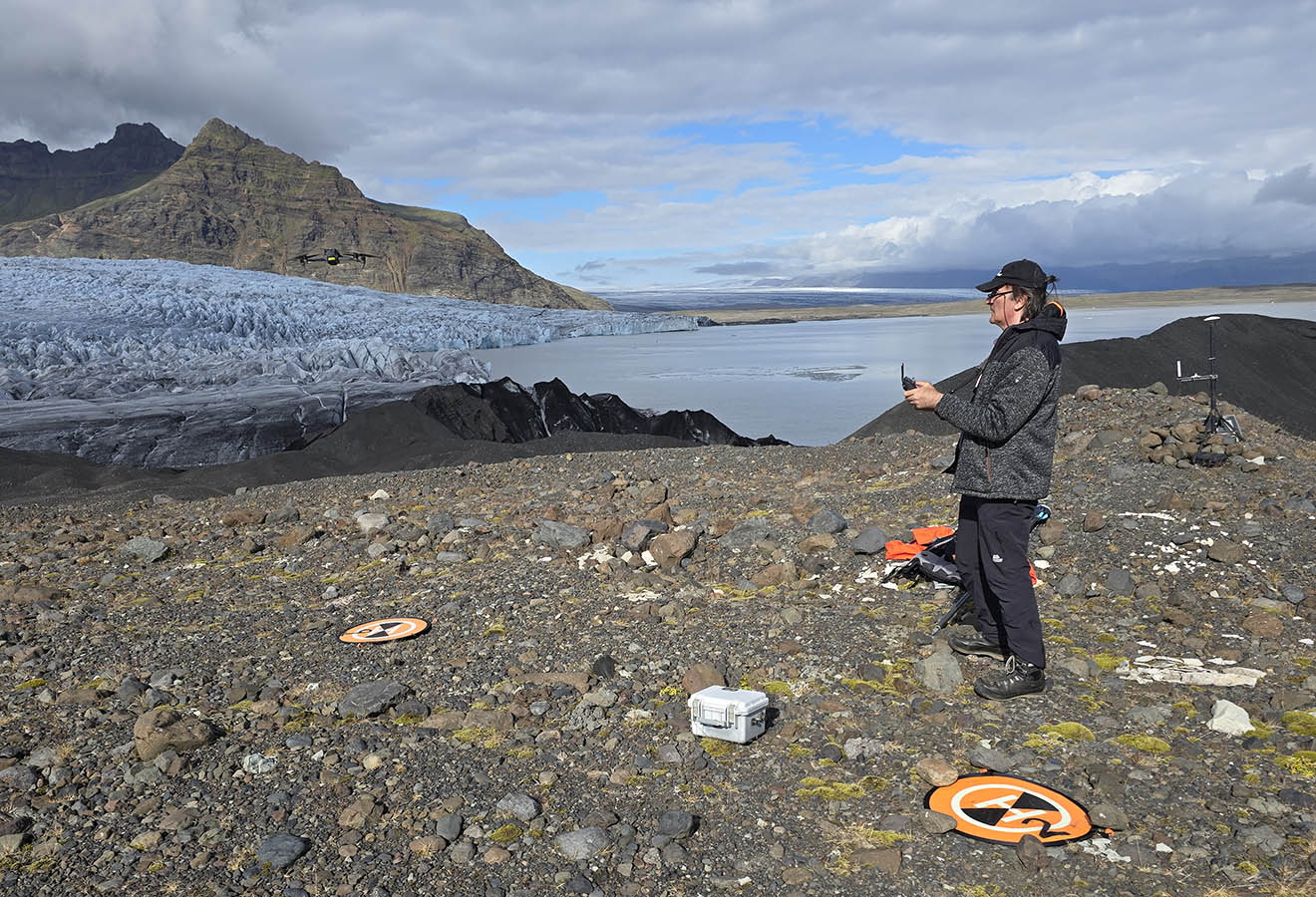
We used a combination of DJI Mavic Enterprise (seen here) and a Matice 300 + P1 camera to re-survey the glacier margin and lake-margin (also an esker we had never seen in person!)

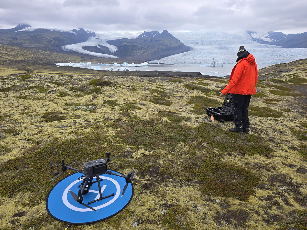
The flight-plans were re-used from the previous year so we could capture the same areas easily.

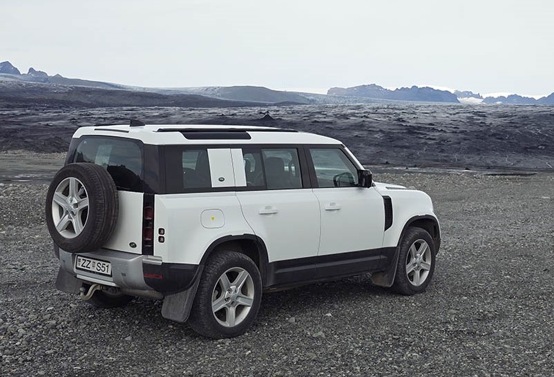
This year we tried the new land rover defender – and it worked very well – including up/down the moraine near Breida.

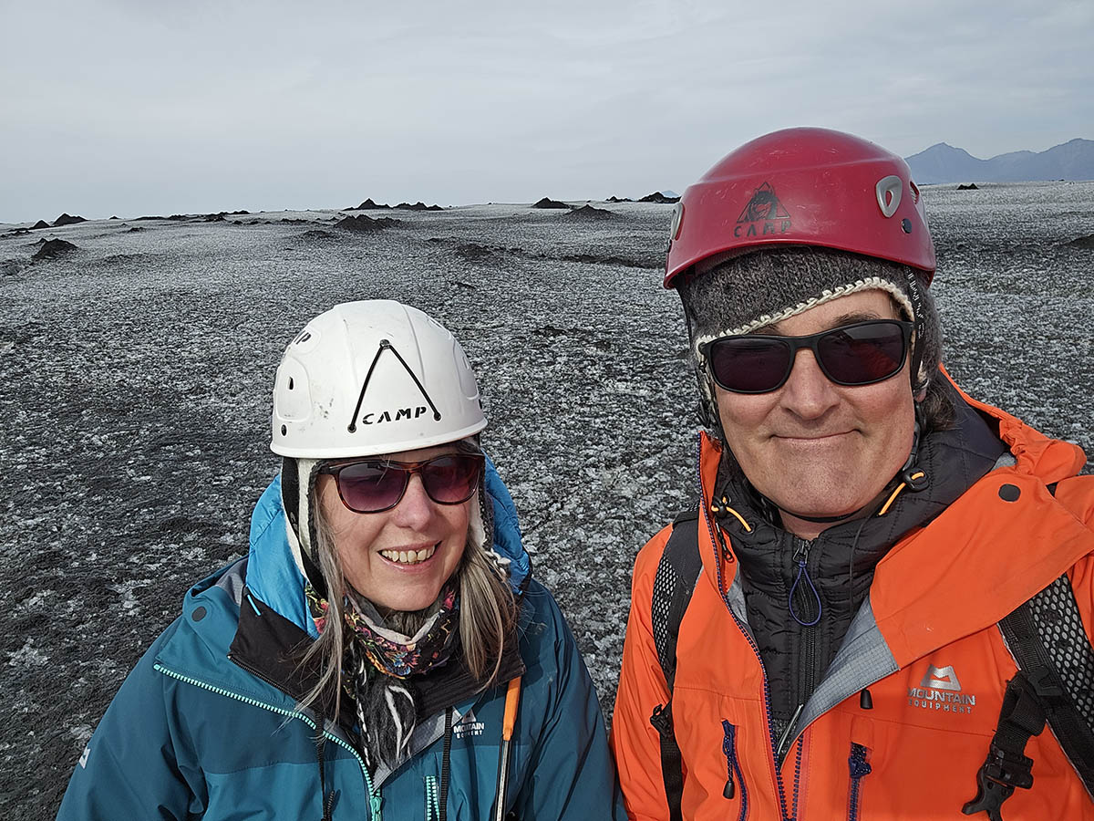
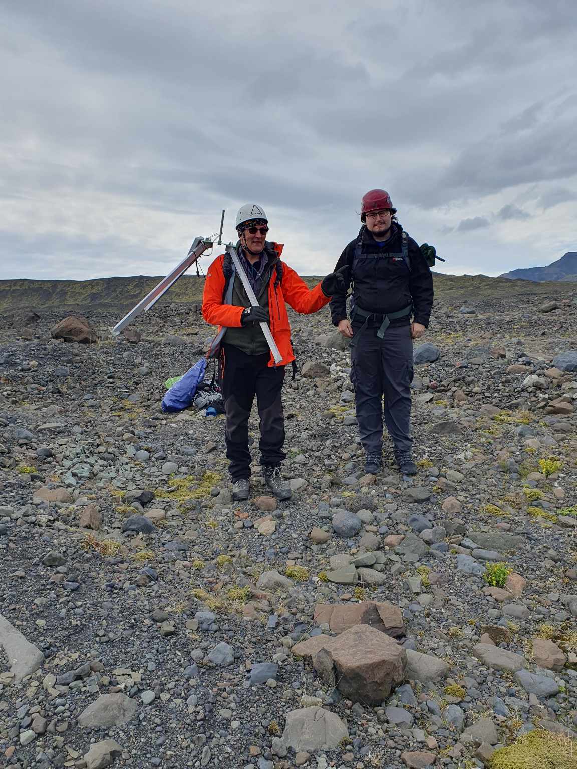
A successful end to the project – good surveys and more data than we hoped for. Here we are on breida (you can tell by the surface!).

Tracker 20 mid-april2024

tracker 20 on Fjalls is still moving progressively in a straight line. It has risen in altitude too. Recent cold weather has stopped solar charging but it is still sending good data. I have deleted fix outliers as it moves less than 5cm but sometimes gets a 1m error.

the tracker had a “glitch” in january – perhaps tilting for a short period or some GPS-related issue – hence the “step” seen in the plots in January.

Fjalls base station is solar charging again

Here we can see the base station battery slowly dropping Bat Voltage during the cold winter – and when the temperatures are below zero it can not charge the battery. After mid feb the temperatures are above zero and the solar charging is working well – bringing the battery back to 100% (around 4V). This means we did the right things to make it work through winters!

IceTracker 20 current status

Looking at tracker 20 on Fjalls we can see it settling into winter – running on battery:

now that average temperatures are below zero the solar charging of the battery is very rare (to save the battery from charging when too cold). It also skipped a few readings in january – which is unusual behaviour – possibly due to its base station misbehaving?

however the Fjalls base stays quite warm (especially in the sun!) so is solar charging OK.

we can see from plotting lat/long that it started to have more outlier readings recently (bottom right). There is usually a very consistent plot of points.

Its altitude jumped upwards in mid december! we can also see the drop due to melting before september and the gradual rise during autumn.

Tracker22 movement and temperatures

Tracker22 has now moved 18m from its original position! – you can see a few outlier spikes due to inprecise GPS fixes but generally the data taken every 3hrs is superb!

Its temperature (not very accurate when it is sunny) has started to dip below zero.

Old dGPS system – ten years ago!

Actually these were installed in 2012 – I just found some more photos showing out first gps ice tracker attempt. All post-processed afterwards (if data recorded!)

our original dGPS recorder on Skalla’ in 2013! Its easy to forget how heavy this was (36kg just the 12AH lead acid batteries!). It ran on its own so it was only possible to check it a couple of times a year. It had three solar panels too!

we painted the tripod red in the hope of finding it – we had to dig it out of the snow one day and it did help.. You can see the tripod bent in the snow..

Early data from the 2023 trackers

on Fjalls – node20 has moved steadily over these six days – showing the sensitivity we have to small movements

on Breida node21 has lost 85cm in altitude in 6 days – (some of that will be the legs melting in). Again the smooth readings show how sensitive the readings are

this early data from the Fjalls base station shows the box gets quite hot in the sun – and the solar panel benefits as the battery is permanently “full”

2023 next generation ice trackers installed

first we installed a new base station closer to the breidamerkurjokull glacier – which had retreated a lot! The new base uses GPRS to send rover data directly to our server.

then installed rover19 at 100m altitude on the glacier

carrying the Fjalls rover20 up to the glacier

new rover20 on Fjalls

We did our first tracker placement using the large UAV (Matrice 300) about 1km away on Breida at an altitude of 130m. We used a camera+release mechanism which gave us a down-looking feed to place it precicely in a safe area (which we can walk to). This tracker 21 has a smaller GPS and radio antenna and a light-weight “quadpod”.