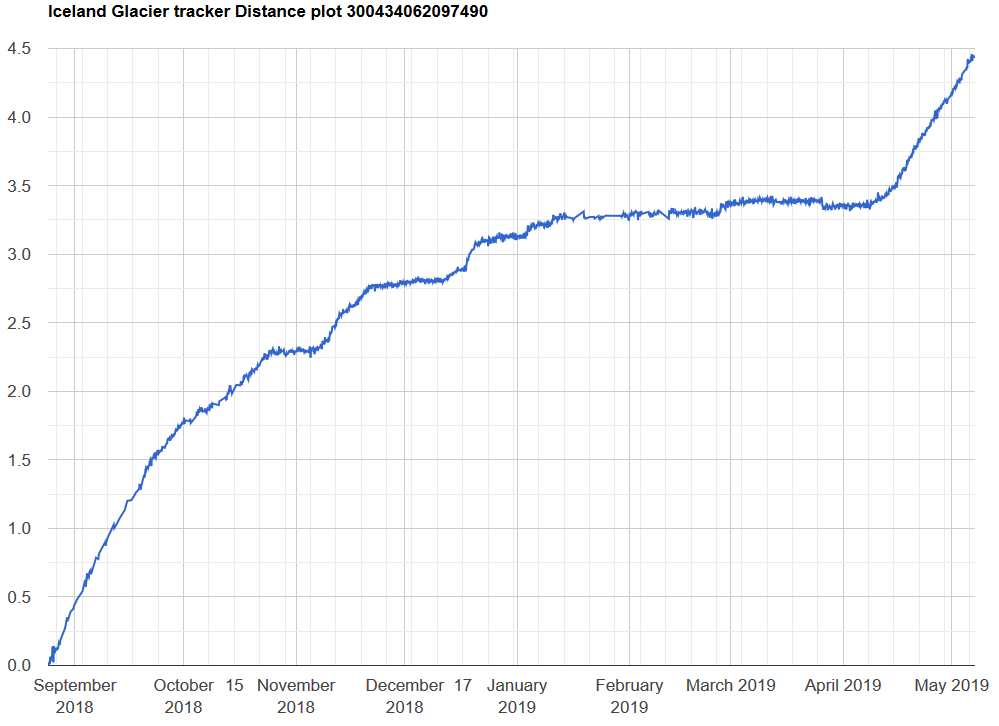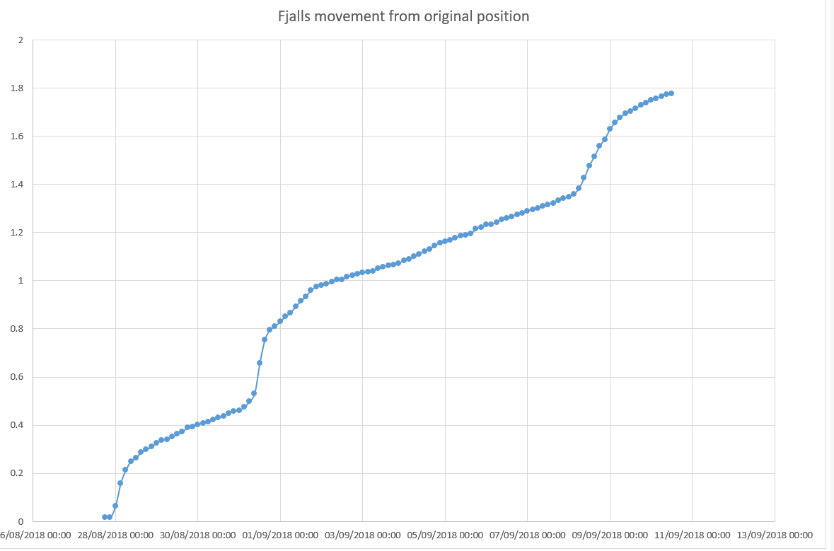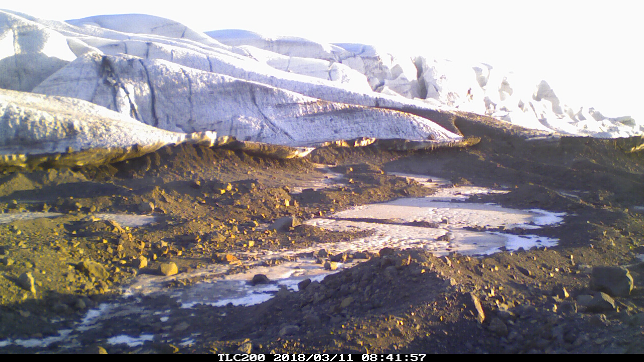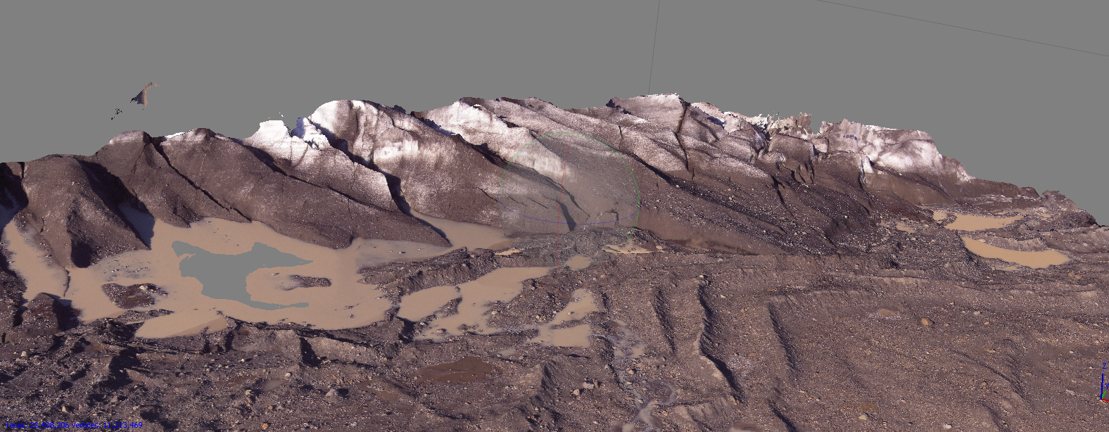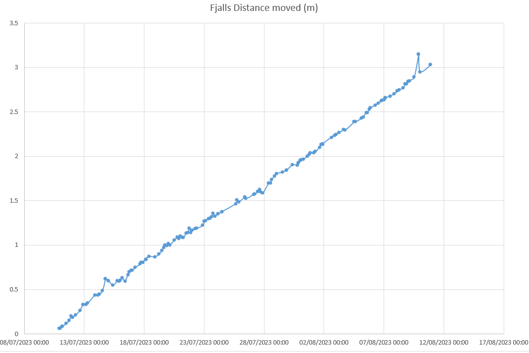
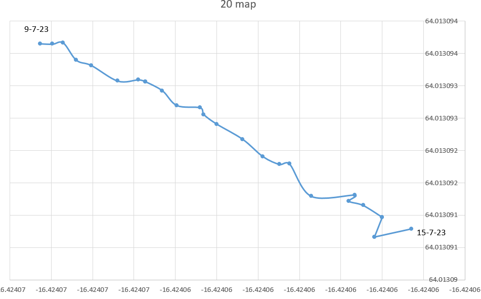
on Fjalls – node20 has moved steadily over these six days – showing the sensitivity we have to small movements
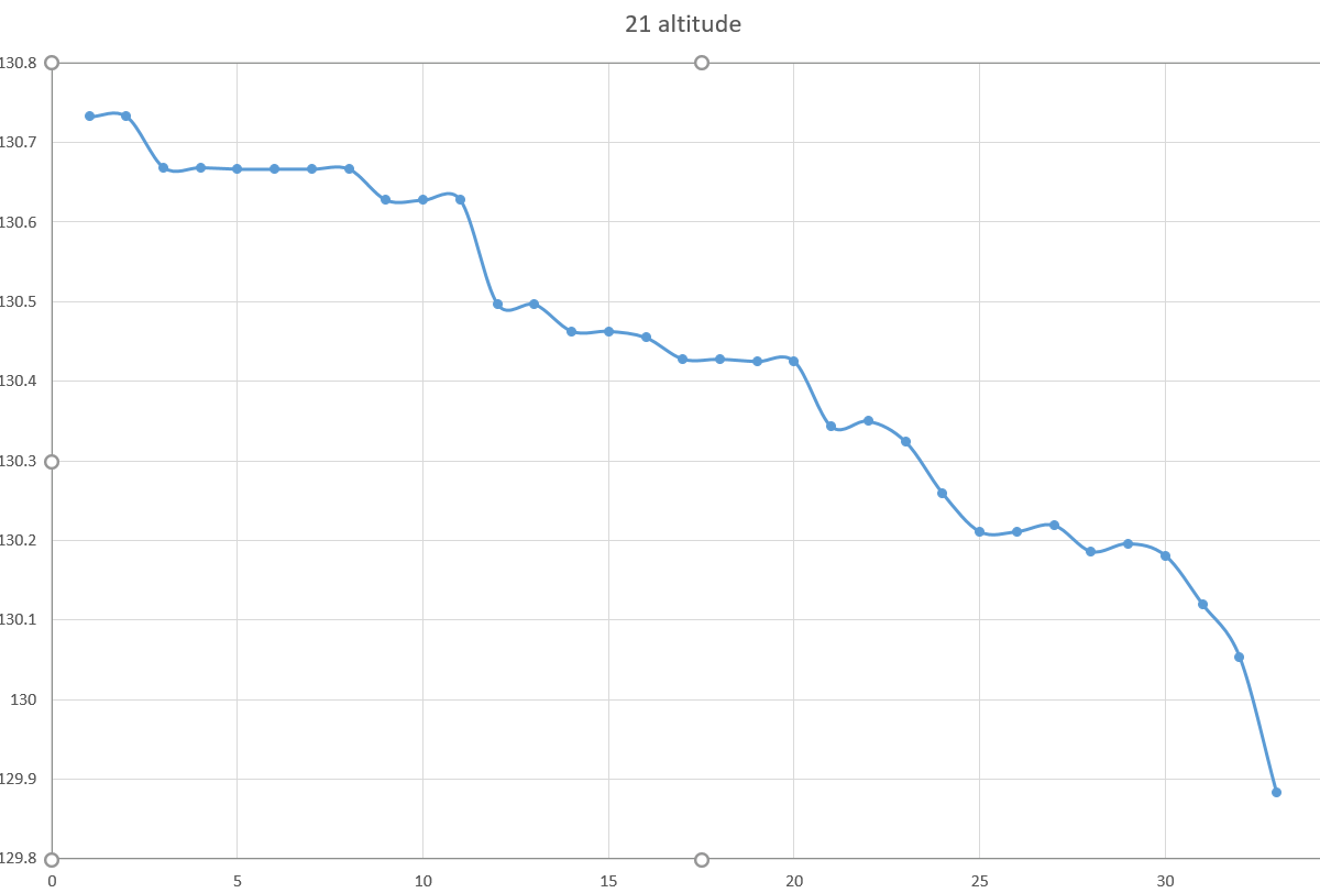
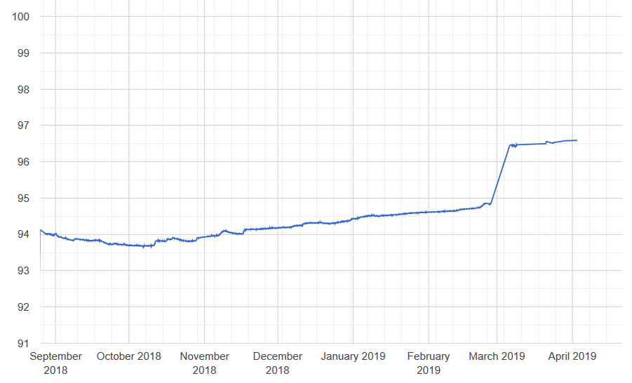
on Breida node21 has lost 85cm in altitude in 6 days – (some of that will be the legs melting in). Again the smooth readings show how sensitive the readings are
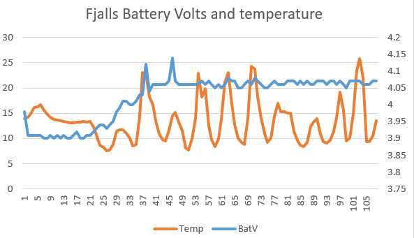
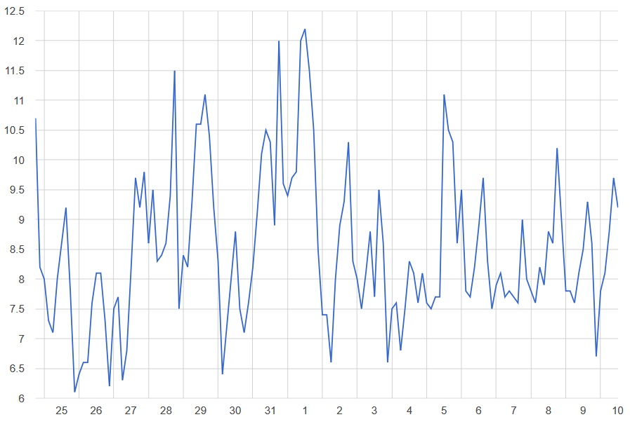
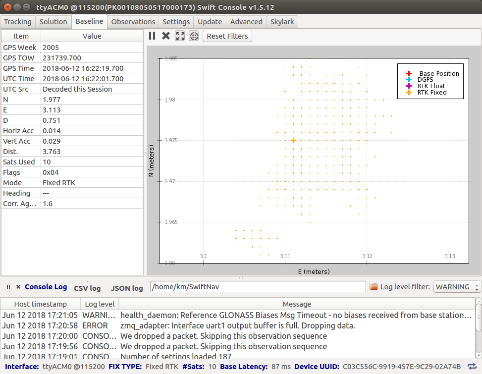
this early data from the Fjalls base station shows the box gets quite hot in the sun – and the solar panel benefits as the battery is permanently “full”