Range testing new systems

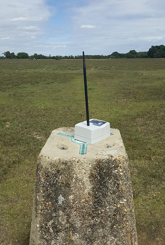
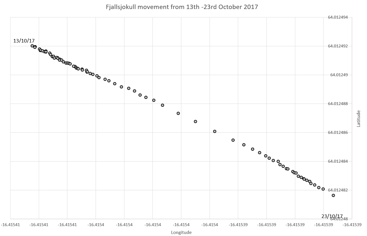
In our mountainsensing project we showed that fully standard communications could cover large areas. For that project we had to add an 868MHz transceiver to our designs. This year we are doing a lot of development with the Atmel SAMR30 based system-on-chip as it includes a sub-GHz radio and has good support in the RIOT-OS. One important thing to test was the typical range to make sure it was similar to our roughly 1km with the previous CC1120. Here is a photo of a quick test in the New Forest which achieved 1km with this set of antennas:

image of test node on trig-point

AGU 2018

Here are some photos from our American Geophysical Union (AGU) conference and visit to National Geographic in Washington.

Our poster about “The Glacier in Winter” – showing the range of processes that occur throughout the winter.
Our poster about the soft-bedded hydrology.
A view across part of the AGU poster hall in Washington. The yellow flags are where the Earth and Space Science Informatics posters are!
Visiting the National Geographic headquarters in Washington – where we met other Explorers and heard excellent short-talks about their research.
The talks in our 2018 ESSI session on “New and Emerging Technologies for Earth and Space Science” chaired with colleagues from NASA.

We also participated in the ESSI organisation and EOS.

Good data coming in already from all nodes!

Here is a quick snapshot of some data from the new Fjalls site:

It is already approaching 2m distance from its original location – also the jitter on the positions is very small.

This is temperature from Rover4’s Peli case, which is the heighest on Breida and is showing good variations (X axis starts in August).

National Geographic Explorer Grant awarded

We have been awarded a National Geographic Explorer grant entitled “A tale of two glaciers: using web connected RTK GPS, drones and remote sensing to monitor rapid glacier retreat of two contrasting Icelandic glaciers”. This will be a two year project to examine the rapid retreat of two icelandic glaciers, using the innovative web connected dGPS system.

Even the GPS system can have faults

“At around 5 AM Pacific Time (1 PM GMT) today (March 7th) the GPS satellites started transmitting inconsistent health information causing Swift Navigation receivers to exclude measurements from any satellites supporting the L2C signal. This has resulted in degraded or unavailable position information and decreased ability to achieve an RTK Fixed solution.”

We kept an eye on the data coming in – as it is not easy to go to Iceland and update the firmware..

This plot shows how the gps behaviour changed after the march 7th announcement. Without knowing this we could have assumed it was caused by something like wet snow cover.


Some movement data

Since fixing the Fjalls system we have a steady stream of data – showing the glacier moving:

This shows a movement of around 1.5m in just ten days.

Fjallsjokull system deployed

Today we set up two dGPS units to measure the speed of some of Fjallsjökull glacier. We chose an area of ice which is clearly moving forward towards the lake.

Here is the dGPS system setup on Fjallsjokull, with Jane Hart and Frey

The photo above shows a “quadpod” supporting the GPS units – which are an adaptation of those made by Matthew Roberts of the Icelandic met-office. The idea is to be strong enough to cope with winter and cast few shadows (which cause ice to grow). The system is currently measuring its position every 3hrs to an accuracy of about 2cm – using signals from the base station to help it.

the dGPS base station installed on a moraine close to the Fjallsjokull glacier. We used speaker stands burried in rocks to support the GPS antenna (top) and hold its 2.4GHz radio antenna (white stick). Shortly after this photo I accidentally kicked sand into the laptop keyboard – so it was not so easy to use after that!

View of Fjallsjokull with our deployement being almost in the middle of this photo.