
Our recent GPS/GNSS research is described on the Ice Tracker page.
In Glacsweb we have used Topcon and Leica dGPS equipment to continuously monitor glacier flow. Normal GPS is accurate to a few metres and would be too inacurate to measure small movements of the glacier. Differential GPS (dGPS) can be much more accurate (millimetres) but requires specialised hardware and software. In previous resaerch we installed several dGPS recorders on the glacier to measure the surface changes over the years. Each recording was processed on our server (together with a “fixed” location recording) to produce a long term record of movement and melting. The NERC equipment pool loan of Leica units allowed us to measure points over a wide area on the glacier as well as place a “fixed” point on the moraine. Read our report here.
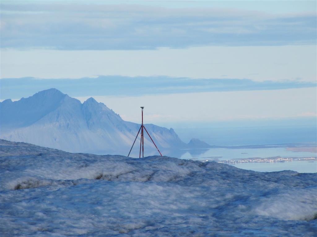
Leica dGPS station
The Leica System 1200 units on loan from NERC used 2.6W when on and around 13mW when sleeping. The overall power use was very high as we recorded for long periods. This experience helped us to design our new ice trackers.
We initially experimented with recordings from simpler (L1 only) Ublox chips (LEA-6) which are much lower cost – at the price of accuracy (we obtained 9cm accuracy, 17cm vertically, with a 2hr recording run against the Leica reference station on the moraine 100m away).
Newer generations of small lower cost dGPS units mean it is possible to deploy more of them for longer (as some use very little power). We moved on to testing if real-time kinematic mode – where fixes are read every second can be used instead of long data recordings. Because the “rover” is in a very similar position and there are increasing numbers of GPS satellites this turned out to be better than expected.
The L1/L2 system we chose for our first RTK experiments in Iceland was the Piksi Multi from Swift Navigation. Within a minute an RTK fix can be achieved with an accuracy of roughly 2cm. It is quite power hungry (3W) but we only turn it on when taking a reading for approx 60s. Our data shows that this approach of trading accuracy for long term readings is a good way forward for glacier monitoring. You need a synchronised base station within radio reach but that can also consume much less power than a normal GNSS.
The 2023 systems used the lower-power Ublox M9P GNSS units in RTK mode to take “live” location readings of points on glaciers for later analysis. This will save battery power allowing for longer battery lifetime. These GNSS units also use more constellations. Experiments with the Ardusimple starter-kits showed us that the xbee sx 868 radios were also perfect for our new designs (using less power than our previous systems).
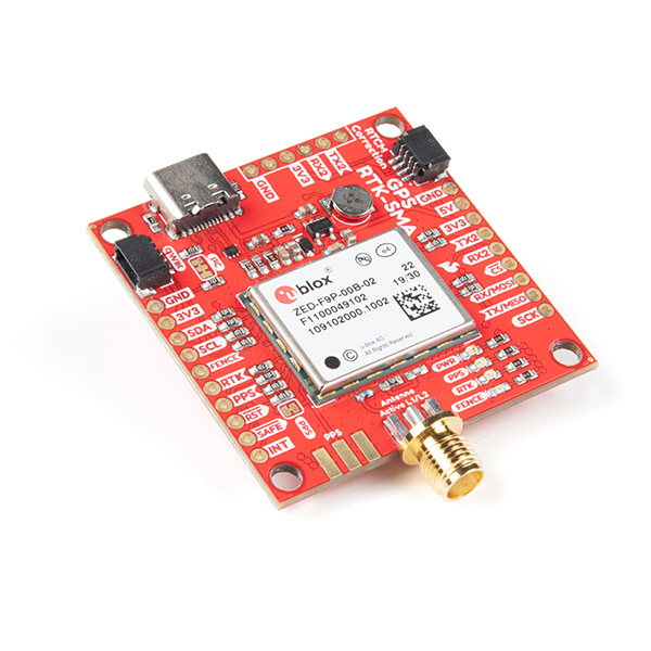
our selected board for the U-blox gps – from Sparkfun – which receive GPS, GLONASS, Galileo and BeiDou in L1C/A and L2C bands. Using modules like this saved us a lot of debug time. The controller was programmed in circuitpython.
This is the final version of the base station boards showing the large lithium battery (blue), GSM module, radio (centre top), GNSS (red top right) and red SAMD51 thing plus controller. Also visible is the small liSoc battery (green and white) used to maintain the real-time clock. on the wire to the right is the temperature sensor.