here is a page on our 2018 Iceland fieldwork

here is a page on our 2018 Iceland fieldwork
The little Brinno camera we left on a monopod last October 2017 continued capturing images until the 9th of June 2018. Here is a frame from a sunny morning in March showing how much the ice drives over the moraine:
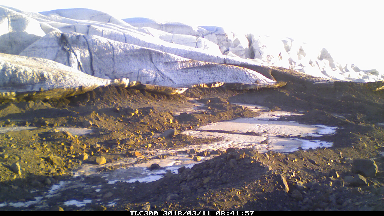
The camera managed this on four lithium AA batteries.
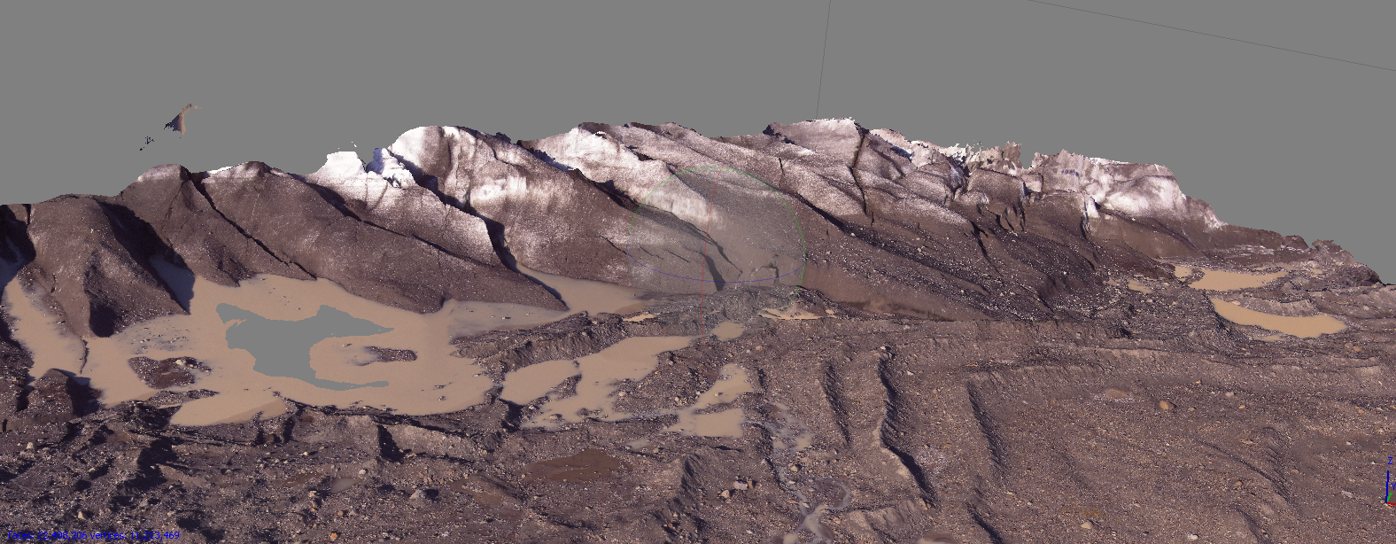
This is a screenshot of the 3D model made of Fjalsjokull (using Agisoft Photoscan) with the images we captured in 2017 with our 3DR Solo/Mapir Survey2 camera.
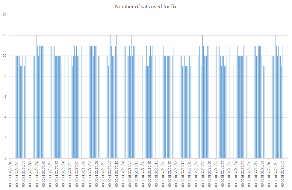
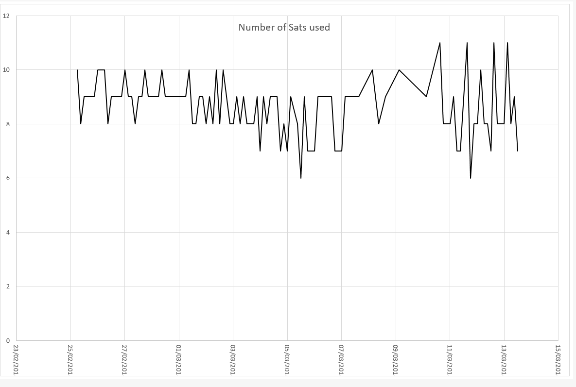
This long term plot for Breida’ show the number of satellites used for each fix. It shows the normal variation due to their paths in the sky. It is quite consistent throughout the winter.
In preparation for deploying more systems in Iceland this summer – I updated our spare Piksi Multis and did a garden test. It performed very well!
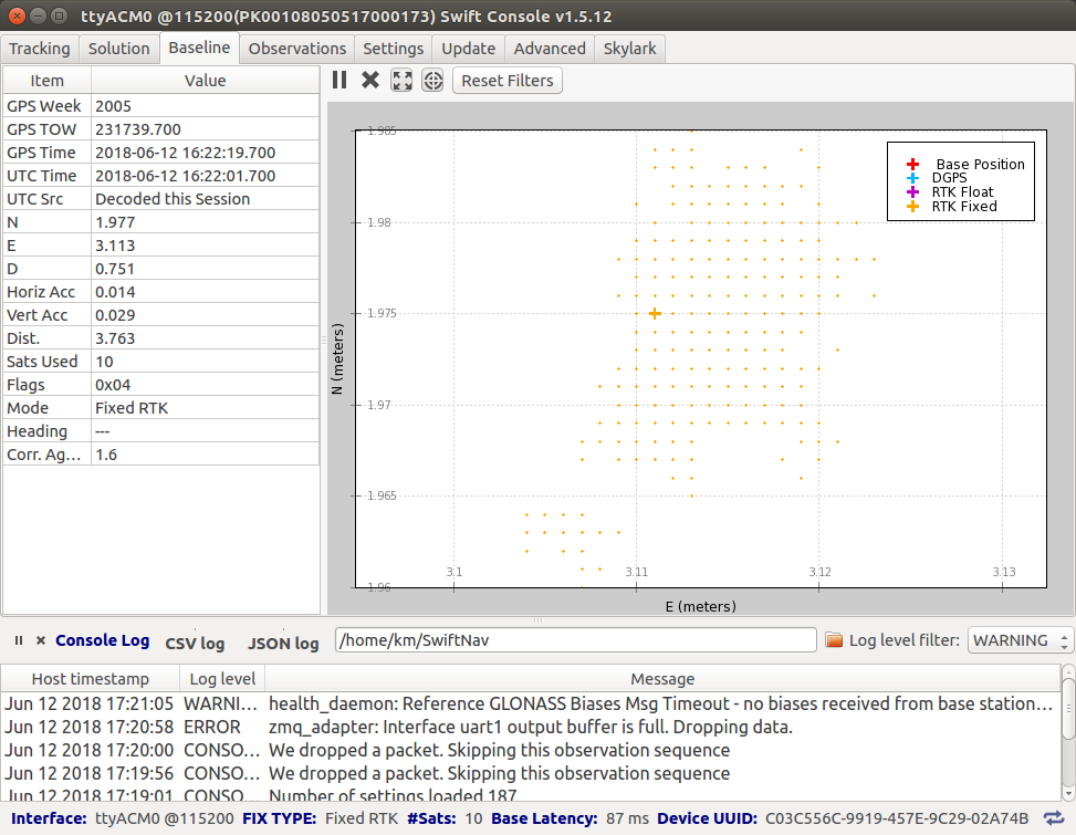
I set them up to fix at 10Hz but report every 5 readings – so its closer to our slow system in Iceland. The fix hopped around within about 1.5cm – which is good for my garden as the sky box is not that wide.
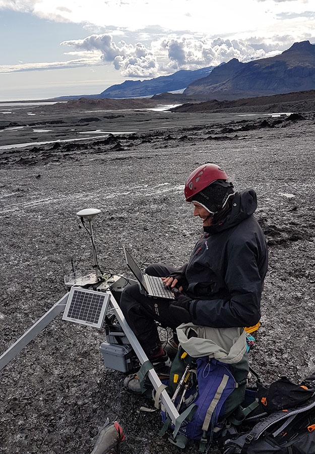
We have been awarded a National Geographic Explorer grant entitled “A tale of two glaciers: using web connected RTK GPS, drones and remote sensing to monitor rapid glacier retreat of two contrasting Icelandic glaciers”. This will be a two year project to examine the rapid retreat of two icelandic glaciers, using the innovative web connected dGPS system.
“At around 5 AM Pacific Time (1 PM GMT) today (March 7th) the GPS satellites started transmitting inconsistent health information causing Swift Navigation receivers to exclude measurements from any satellites supporting the L2C signal. This has resulted in degraded or unavailable position information and decreased ability to achieve an RTK Fixed solution.”
We kept an eye on the data coming in – as it is not easy to go to Iceland and update the firmware..
This plot shows how the gps behaviour changed after the march 7th announcement. Without knowing this we could have assumed it was caused by something like wet snow cover.
There is a nice write-up from Formula E on Ice drive: a lasting legacy:

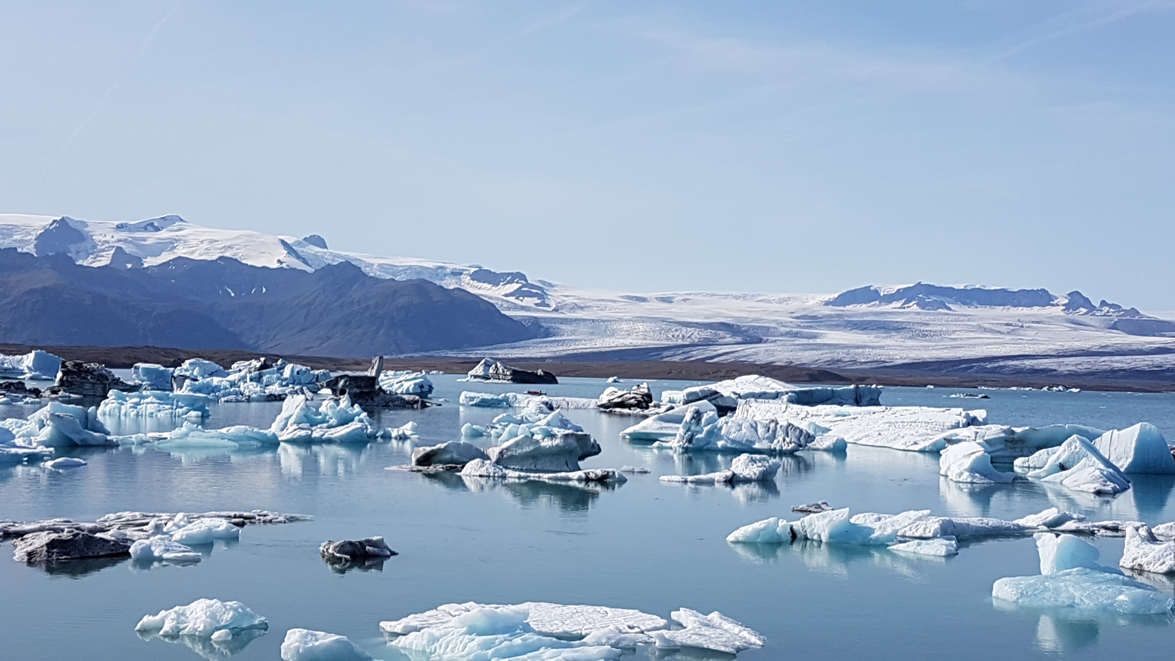
We just edited some footage of the fjallsjokull margin
Here you can see the recently exposed foreland and its moraines.
(video taken with 3DR Solo and GoPro5 – without gimbal – hence the slight wobble)
Since fixing the Fjalls system we have a steady stream of data – showing the glacier moving:
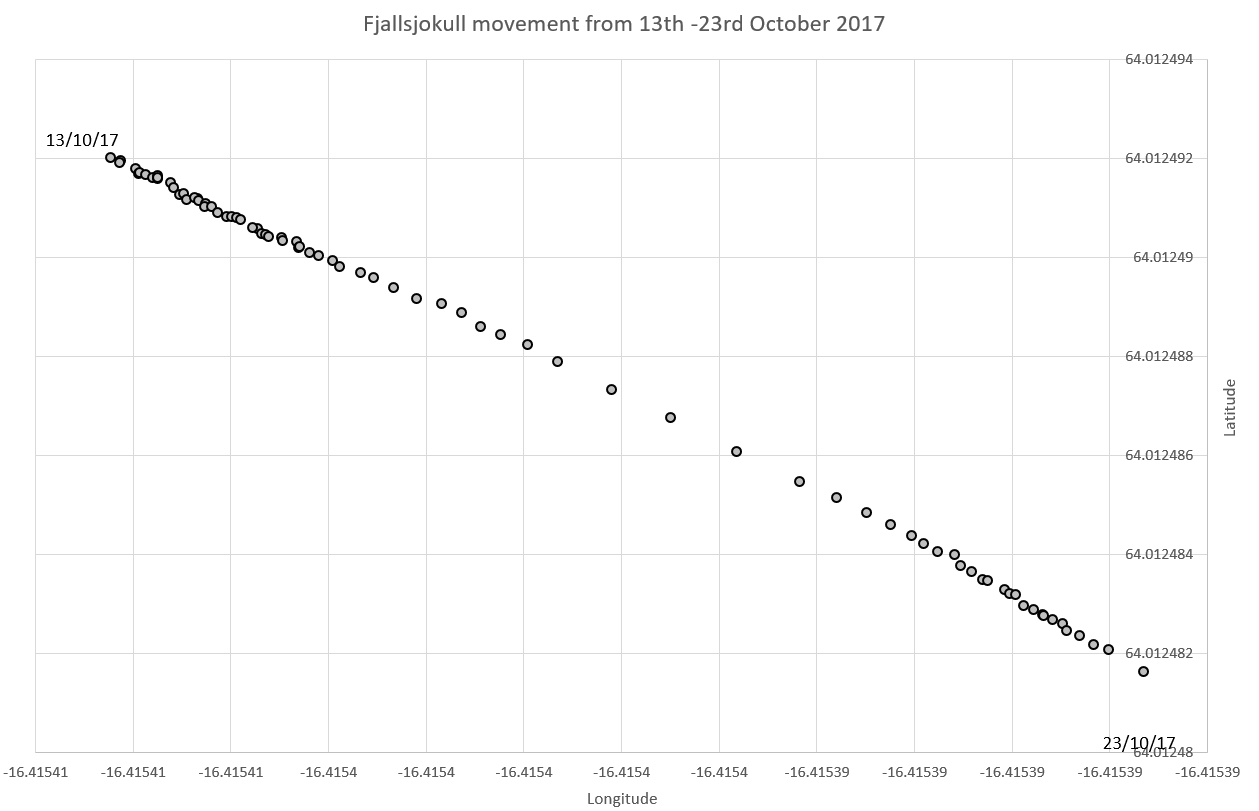
This shows a movement of around 1.5m in just ten days.